For those who enjoy driving holidays, this is a good route to explore the NSW coastline between Bulahdelah and Coffs Harbour and get a glimpse of the Oxley Wild Rivers National Park.
You will see some of the best waterways, the best beaches and national parks in NSW.
During winter, the area is far less crowded than in summer, the days are sunny but not too hot and the air is crisp and clean.
Bulahdelah
We left Sydney via the Pacific Highway (F3) early on Saturday morning of the June long weekend. After nearly three hours driving, the first stop was at Bulahdelah where we love to call into Café on Main for delicious home-made cakes, sandwiches, hot chocolate and coffee. The town was busy with travellers making their way north for the long weekend.
Seal Rocks
Keen to see Seal Rocks, we continued along the Pacific Highway and just past Bulahdelah, turned right onto The Lakes Way. At Bungwahl we turned right onto Seal Rocks Road. This is a very worthwhile side trip and only takes 15 minutes each way (12kms each way with 2kms gravel road).
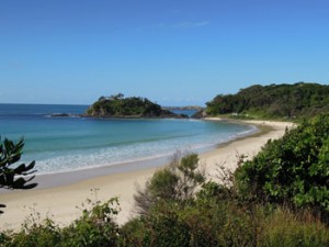
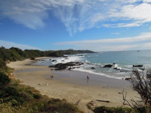
Seal Rocks is a beautiful, unspoilt beachside hamlet that has managed to escape development. There is a holiday park, some holiday homes and a Post Office that doubles as the local shop. The first beach you see is Number One Beach. The next beach is Boat Beach. Both are gorgeous.
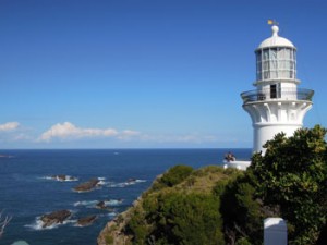
For us, a highlight of Seal Rocks is Sugarloaf Point Lighthouse.
Take time to take the short walk up to the lighthouse, built in 1875. Along the way you will see a narrow inlet on your left known as Seal Rocks blowhole. Further on take the pathway right to Lighthouse Beach, or keep going up to the lighthouse cottages and then take a steep pathway up to the lighthouse itself. The views are fantastic. Visitors can walk up the exterior stairs of the lighthouse for even more spectacular views. The lighthouse cottages have been beautifully restored and are available for accommodation rentals.
Pacific Palms – Blueys Beach – Boomerang Beach – Elizabeth Beach
From Seal Rocks we drove back out to The Lakes Way at Bungwahl and headed in the direction of Forster. Just beyond Bungwahl the drive is very scenic with beautiful views of Smiths Lake on the right.
At Pacific Palms turn right onto Boomerang Drive to visit Blueys Beach, Boomerang Beach and Elizabeth Beach.
To get to Blueys Beach, just beyond the Blueys Beach shops, turn right at Blueys Way then take the first right (Newman Avenue) which takes you down to Blueys Beach. This area is very popular in summer and has many upmarket holiday homes.
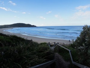
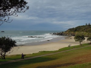
Back on Boomerang Drive, follow it around to Boomerang Beach. At the southern end there is a lookout point and stairs down to the beach. On the day we visit there are only keen surfboard riders out in their wetsuits. Along Boomerang Beach Road you will come to a lovely park at the northern end of the beach. This is an ideal place for a picnic and there is a timber platform to take in the views.
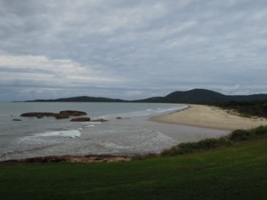
Next follow Lakeside Crescent around to beautiful Elizabeth Beach. There are several points from which to access the beach but we like to walk through the rainforest track opposite the Pacific Palms resort.
Lakes Way – Wallis Lake – Seven Mile Beach
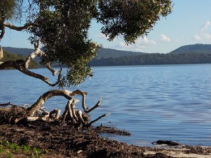
From Elizabeth Beach it’s back onto The Lakes Way with beautiful Wallis Lake on our left. Sunset Point Picnic Area is a great place to stop and enjoy views over the lake. On the right, Booti Booti National Park Ruins Camping Ground is an open grassy area with Seven Mile Beach just over the dunes.
Keep an eye out on the left for a sign – Green Cathedral Ministries – just before the Sundowner Tiona Caravan Park.
It’s worth stopping at Green Cathedral – a popular place for weddings. The ‘cathedral’ is an outdoor setting on the edge of Wallis Lake under a rainforest canopy.
Forster
Follow The Lakes Way into Forster. At Marks Street, turn left and follow the road around into Little Street that runs along the edge of the river. This is a pretty drive passing boatsheds, Forster Marina, cafes, parklands, a boardwalk and bike hire, kayak hire and boat hire. The Forster/Tuncurry Tourist Information office is on Little Street on your right.
Wharf Street is the main street of Forster and is an attractive, tree-lined street with shops, cafes, banks, etc. It’s an ideal place to stop for coffee, ice cream or a snack.
Forster’s beach is called Main Beach and is at the end of Beach Road. The beach foreshore is not as attractive as others we have seen on the mid-north coast of NSW, however the beach is clean and the water clear. Beachside Beach Bum Café is a popular place for breakfast and lunch.
From the beach we drove around to the marina area near John Holland Park where there was a flock of pelicans gathered around fishermen cleaning their catch, and dolphins frolicking in the river mouth. From here there are good views across to the bridge linking Forster and Tuncurry.
Port Macquarie
It was getting late and we still had a way to go to Port Macquarie where we had booked accommodation.
Back onto the Pacific Highway we drove through the Manning Valley – lovely green, flat pasture land with mountain views in the distance.
At Kew, we turned right onto Ocean Drive to take the coastal road to Port Macquarie (Tourist Drive 10). At Laurieton continue on Ocean Drive towards North Haven. It is worth stopping at North Haven Beach – a beautiful beach lined with Norfolk Pines. Continue along Ocean Drive and enjoy spectacular views from the headland at Bonny Hills. Continue on through Lake Cathie to Port Macquarie.
In Port Macquarie we had booked accommodation at Koala Tree Motel. We had our little dog with us so we chose the motel as it was pet friendly, a good price and had very good reviews on Tripadvisor. We weren’t disappointed. Our deluxe room was spacious, modern, clean and excellent value for money. We had a small veranda and could park right outside our room.
The owners of the Koala Tree Motel have put a lot of thought into guest facilities. There is a kitchenette equipped with microwave, cutlery, crockery, toaster, kettle and bar fridge. We had a small glass table in the room plus a third chair at the bench near the telephone, free WIFI, a sofa plus ottoman, iron and ironing board, large flat screen television and most importantly a very comfortable queen bed. The bathroom was also spacious with plenty of electric power points for the hairdryer, fluffy white towels and a good shower. We can highly recommend this motel.
Port Macquarie is a thriving place. The town has a great feel with tree lined shopping streets, riverside parklands, ocean view apartments, fabulous beaches and many attractions in the town and surrounding areas.
Port Macquarie Attractions
The Port Macquarie Coastal Walk is a highlight. It is approximately 9kms of scenic coastal pathway along which you will see some of Port Macquarie’s best attractions:
- Town Beach
- Oxley Beach
- Windmill Hill Reserve
- Rocky Beach Lookout
- Flynns Beach
- Nobbys Beach and Kenny’s Walk
- Harrys Lookout
- Shelley Beach
- Sea Acres Rainforest Park
- Miners Beach
- Tacking Point Lighthouse and Lighthouse beach
Also take a stroll along the Port Macquarie’s riverfront area known as Town Green. Enjoy views over the Hastings River and Lady Nelson Wharf. Have a family picnic or enjoy a meal at the hotels and cafes overlooking the river. Take a river cruise from Clarence Street Wharf or a dolphin and whale watching cruise in season. Time permitting try to visit the Koala Hospital or the popular Billabong Koala & Wildlife Park.
Timbertown at Wauchope is another popular attraction worth visiting.
Port Macquarie to Coffs Harbour
Coffs Harbour is a 2 hour 20 minute drive north of Port Macquarie and is a good day trip. We made a long day of it by driving to Coffs Harbour via Southwest Rocks and then returning to Port Macquarie via Bellingen.
We made an early start Sunday morning and headed north on the Pacific Highway.
We drove through a pleasant little town called Frederickton where the main attractions seem to be Fredo Pies, Licks ice creamery and the Old Cheese Factory. Just north of the town, turn right off the Pacific Highway onto Plummers Lane when you see the sign Southwest Rocks/Trial Bay – Tourist Drive 12. (You will also return to the highway via the same road to continue on to Coffs Harbour.)
Southwest Rocks
Southwest Rocks is a 15km drive off the Pacific Highway. It is an unspoilt seaside village with fabulous scenery, beaches and national parks.
Southwest Rocks attractions include:
- Arakoon National Park – where you will find Trial Bay Gaol. You could spend a whole day touring the gaol and museum, bushwalking, swimming, or enjoy a picnic.
- Smoky Cape Lighthouse
- Hat Head National Park
- Diving Fish Rock Cave
Coffs Harbour
From Southwest Rocks it is 1.5 hour drive north to Coffs Harbour.
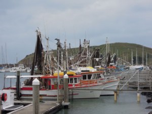
Arriving into Coffs Harbour Sunday morning, we headed down to the harbour. It was very busy as there was a market and carnival in progress. The jetty is home to the fishing fleet, adventure tours, whale watching tours, beach to bush buggy tours and a couple of restaurants. The Coffs Harbour Yacht Club looks a very pleasant place to enjoy a meal on the balcony and take in the view. From here you can also walk to Muttonbird Island where you can enjoy fabulous views back across Coffs Harbour, the coast and hinterland.
Back along Harbour Drive, just across the railway line, there are some good cafes and a couple of interesting shops.
If you want to see Coffs Harbour’s most famous landmark, head north of town to the Big Banana.
Bellingen
Leaving Coffs Harbour we headed south again along the Pacific Highway and about 22kms out of Coffs Harbour took Waterfall Way to Bellingen (12kms) – a beautiful drive.
Bellingen is a very attractive village and artistic community. There are many cafes and interesting shops. The surrounding countryside is spectacular. It is a place worth spending time.
There is plenty of accommodation – everything from B&Bs to country cottages, guesthouses, retreats and farm stays.
Try to be in town for the Jazz & Blues Festival, Global Music Festival or the Bellingen Markets – one of the best markets on the coast.
Explore Dorrigo National Park and walk the 70m skywalk at the Rainforest Centre.
Leaving Bellingen, it was about a 2 hour drive back to Port Macquarie on the Pacific Highway.
Oxley Highway from Port Macquarie to Walcha – Oxley Wild Rivers National Park
On Monday morning, instead of heading directly back to Sydney on the Pacific Highway, we took a scenic route through the Oxley Wild Rivers National Park, Walcha and Gloucester – about 590kms.
The first part of the trip from Port Macquarie to Walcha on the Oxley Highway includes at least 50kms of winding road. It’s quite a long drive – if you drove without stopping it would take 2 hours 15 minutes (but that defeats the purpose!).
There are only a couple of places along the way to buy food and drinks so it may be worthwhile taking your own supplies. Otherwise keep a lookout for the Timbercutters Café and the Gingers Creek Bush Retreat Café along the way.
There is talk about this route becoming part of the Slim Dusty Way as this was the road driven by Slim Dusty and his wife Joy in 1954 for their first performance at a small country hall in Walcha (The Slim Dusty Centre is currently being built in Kempsey, Slim Dusty’s home town).
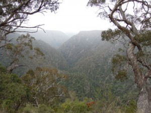
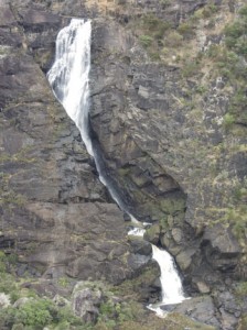
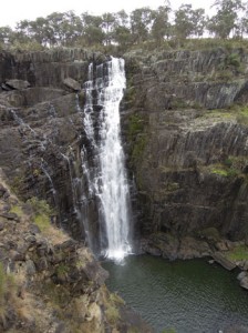
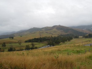
The countryside along the Oxley Highway is beautiful. You will pass through rolling hills, wide open farmlands, timbered country and rainforest. The highlight of the drive was visiting two waterfalls and spectacular gorges in the Oxley Wild Rivers National Park.
Tia Falls
Our first stop along the Oxley Highway was at Tia Falls.
Take the 7kms of gravel road through pretty grazing farmlands to a small car park with picnic tables, gas BBQs and clean bush toilets. The crisp clean air and the smell of the Australian bush were divine. We followed the signs to Tia Falls lookout point where there is a view of the Tia Falls and gorge – it’s breathtaking. The walk is a little steep on the way back to the car park.
Tia Falls has two main walking tracks. We did the shorter walk (30-40 minutes return) to Tia Falls Lookout and Tia Gorge View. If you have time, the longer Tiara Walk crosses the Tia River footbridge to the western side of the gorge to Tiara View and finishes at Tiara Lookout (1.5-2 hours return).
Apsley Falls
Back on the Oxley Highway, just a few kilometres further along is a sign to Apsley Falls and Oxley Wild Rivers National Park. The falls are about 1 km off the highway. On your right you will see Lions Lookout with views over the gorge. On your left a new pedestrian bridge is being built (the old one was washed away).
Park at the Falls Lookout car park and take the wheelchair friendly pathway to the lookout. There are steep stairs down to another 2 viewing platforms and it’s well worth the effort. The views are spectacular and surprising. There is no hint of the enormity of the gorge and the height of the falls.
There are two walking tracks at the Apsley Falls.
The first is the Gorge Rim Walk which is a 1km loop track along the gorge rim to Lions Lookout passing two other lookout platforms.
The second is the 2.7km return Oxley Walk to the lower falls. It crosses the Apsley River footbridge and continues around the north side of the gorge. The Oxley Walk offers fantastic views of the main and lower falls from four different viewing platforms. This walk takes about 1.5-2 hours return.
At the Lions picnic area there are BBQ, picnic and toilet facilities.
Walcha
It was a very cold day and we stopped in Walcha for lunch. It was a very quiet town on our visit – no doubt due to the weather. We had a delicious toasted sandwich at the local milk bar/café. The wind was icy and it was just too cold to go looking for the street sculpture that we had read about.
At the Visitor Information Centre we received excellent and friendly advice on the best way back to Sydney. We were advised to take Thunderbolt Way via Gloucester (it’s a 1 hour 45 minute drive between Walcha and Gloucester) – and it was recommended that we stop at Carsons Lookout on the right hand side.
Just after Carsons Lookout there is a very steep descent. Keep an eye out for Bretti Nature Reserve – a beautiful campsite (or picnic area) next to the Manning River.
Gloucester to Sydney
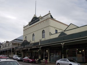
At Gloucester we took Bucketts Way south through Stroud which was established in 1826 and had some very attractive historic buildings.
The road continued on through rolling hills, farmlands and a pretty vineyard until we joined the Pacific Highway about 45 kms north of Newcastle. From there it was an easy drive back to Sydney on the F3 freeway.
AccommodationGuru.com
June 2012

